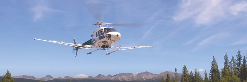
High-resolution imagery captured by slow-moving helicopters has given B.C.’s resource industry its most detailed look at potential mineral deposits in northern B.C.
Bruce Madu, vice-president, minerals and mining, with Geoscience BC, said the helicopters flew just 80 metres above the ground in “go-slow” mode and a tight grid formation to map 9,600 square kilometres of northern terrain. The flights followed grid lines just 250 metres apart.
“The resolution is the best I have ever seen,” Madu said.
Referred to as a “treasure hunt” by some Geoscience BC staff, the mission will provide resource companies, governments and First Nations information on potential mining deposits in a remote swath of the Peace River Regional District.
Geoscience BC is an open-source public information agency that seeks out new information about what lies beneath the surface dirt in British Columbia. It seeks out baseline data about the composition of the subterranean earth in this province. That information is then used by mining companies, petroleum companies and other industrial interests that need to make the most educated guess about where to concentrate their expensive investment efforts.
But the data is also available free to environmental groups, local governments and anyone else with an interest in land-use planning.
Last month Geoscience BC disclosed the findings of its exhaustive scan of the land in the general vicinity of Williston Lake north of Prince George and Mackenzie. It is already home to the Kemess mine, so valuable mineralization was empirically known to be located in that area. The new high-tech report will give a better subsurface view of what’s around it.
The data can’t tell what specific minerals – such as gold or copper – may be found, but provides clues to which areas hold potential.
This science mission was known as the Search Phase 3 (SP3) project, as it was an extension of two similar scans done in other nearby plots of land. Although the SP3 parcel covered a space nearly 10,000 square kilometres in area, the helicopter carrying the scanner had to fly a course more than 40,000 kilometres long equal to the entire circumference of the planet.
All results – from raw data to a series of summary maps – are available publicly for free.
The SP3 operation cost about $1.7 million but “projects like these are proven to bring new investment to the province,” Madu said.
Agreed, said Joel Mackay, CEO of Northern Development Initiative Trust, which invested some of the money in the research program.
“The mining sector in British Columbia is gaining as commodity prices recover, creating new potential investment opportunities that will benefit communities across northern B.C.,” Mackay said. “This data is critically important to informing mineral exploration decisions and helping our region capitalize on global trends. We continue to value our partnership with Geoscience BC and commend them for their work on Search Phase 3.”
The portion of the mining industry most affected by research like this is the exploration sector. Small “junior” mining companies – sometimes just mom-and-pop operations and sometimes affiliates of major companies – are the ones that typically go out into the wilderness and put the geological pieces together that eventually lead to major deposit discoveries and become mines.
This kind of work usually takes many years. Data like the SP3 information helps to speed that exploration work up and be more accurate.
“[This is] just the sort of regional data set that is most useful to the mineral exploration industry in the search for new mineral deposits in the province,” said David Moore, president and CEO of Serengeti Resources, a junior mineral exploration company. “The scale of this new survey provides plenty of opportunities for future discovery.”
Edie Thome, president and CEO of the Association for Mineral Exploration, agreed, saying, “Data from Geoscience BC surveys like Search Phase 3 are proven to bring investment and lead to discoveries in British Columbia.”
The three-scan project now provides high-quality and up-to-date data on potential mineral deposits covering 65,100 square kilometres of northern B.C., Geoscience BC noted.


